Hiking, travel, and life in general

Thursday, March 29, 2018

Columbus Chattahoochee River Walk 3-21-18

Most of my work during the month of March had me in Tifton, GA. I hate to say it but there is really not a lot going on in Tifton. I searched for a park with a nice walking trail or some kind of outdoor recreation area but did not find much. I didn't have much time in the afternoons after work to drive anywhere and didn't want to be out in an unfamiliar area by myself, so most of my physical activity was limited to the hotel gym. 

During part of the month though, I was in Columbus. Due to "springing forward" and also the fact that Columbus is practically in central time anyways, I had a lot more daylight to work with. The weather has been mostly horrendous all month but I had one or 2 ok days while I was in Columbus. So of course I had to see how the Chattahoochee down there compared to my beautiful river up here north of Atlanta. I was delighted to find a 15 mile long walking path along the banks of the river (I could have walked to Alabama, but why would anyone do that?). My part of the river is more scenic because obviously the area around the river in downtown Columbus is developed and has a lot of buildings, traffic, etc. I'm sure as you get away from the city, the river and scenery becomes more serene. The path itself is lovely; it's very wide and flat, which makes it great for bicyclists, joggers, and walkers. 

I only walked a mile or so on the path after starting at Woodruff Riverfront Park near downtown, because I also planned to walk around downtown Columbus. It was extremely windy and cold and very few other people were out and about. I did see some kayakers, as this part of the river is quite rapid-y, and fisher folk. I was also shocked to see motor boats on the river. I walked down to some old mill buildings and looked around there and also walked across a small bridge onto an island, which would be a great place to hang out if it wasn't freezing and windy. 

After walking along the river, I went up into downtown Columbus (which is apparently also known as Uptown). It's slightly sketchy but overall I found it quite nice. I went in a great coffee shop and met several storefront dogs who were hanging out on the sidewalk in front of their respective shops. I always like to support local businesses and there were quite a few in downtown Columbus. There seems to be a culture of coffee, beer, and bicycles (and dogs) in Columbus and I can't argue with any of that. There is also a lot of public art. It seems like they are really trying to make it an interesting place. Just my assessment after spending a few hours there. 

So in a month of traveling for the first 3 weeks and rainy weather every weekend I was home (not joking), I am happy I managed to find a little adventure wherever I could. There are many places near Columbus I would like to go such as the Warm Springs area and Providence Canyon but alas, no time for that when working. Maybe another time..

Thursday, March 1, 2018

Augusta "Locks" 2-21-18

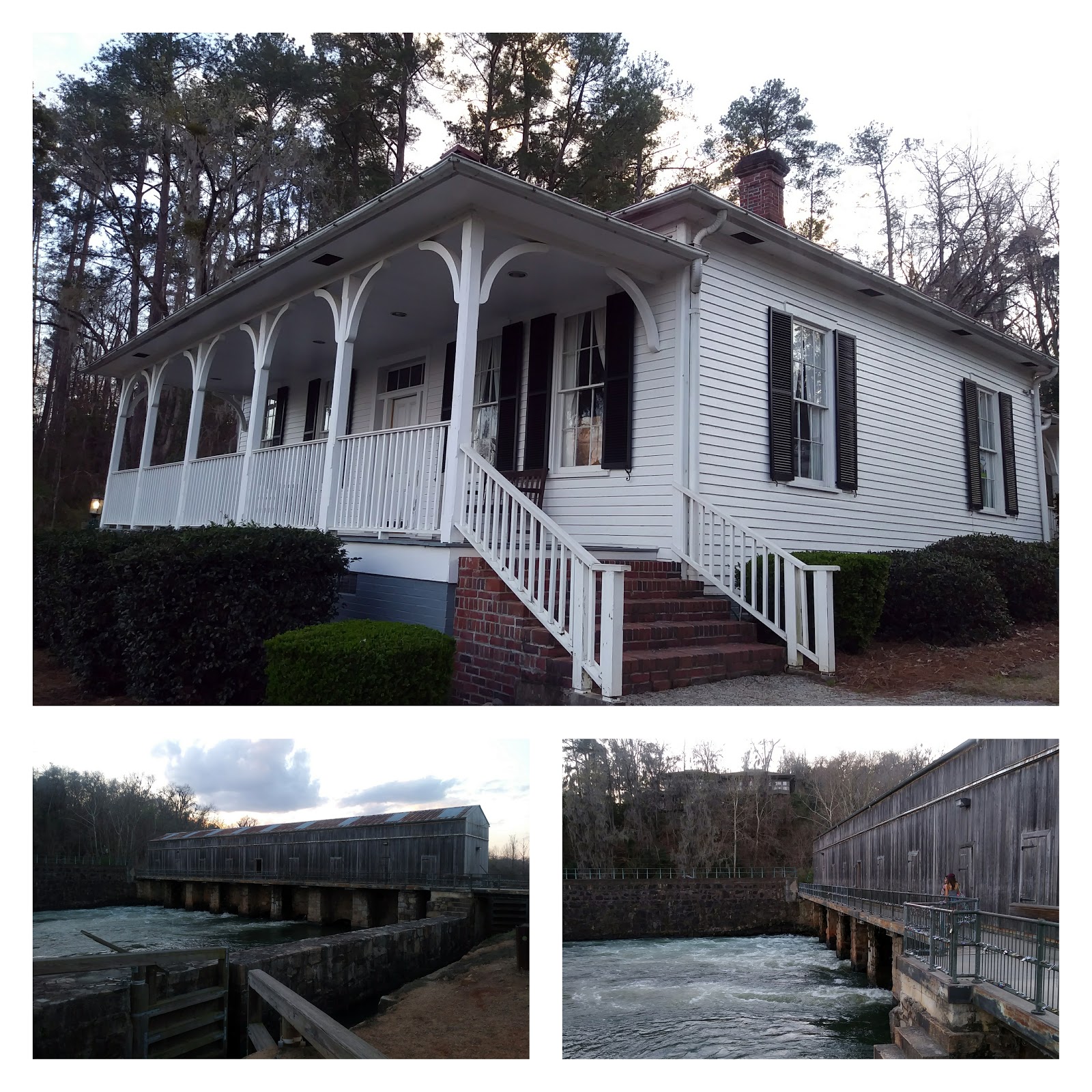
I have been traveling a lot in the month of February so between that and the mostly horrible weather we've had all month, there has not been much outdoor recreation. We did go to Little Ridge Park and Bowmans Island (in the rain- very muddy) a few times but really my only new or interesting excursion was in Augusta last week. Actually, it was in Martinez and make sure you pronounce that correctly (Martin-ez)!! Again, I was traveling for work so didn't really have much time for leisure each day but I did manage to go to Savannah Rapids Park one day after work. I visited this park before about 7 years ago when my sister-in-law lived in Augusta, so I made a point to go back.

The park is situated at the headgates of the Augusta Canal and the property also includes historical features such as a Lock Keeper's cottage (add Lock Keeper to my list of old school, preferred professions). It's different than a lot of places I hike in that the history of it is just as interesting as the scenery. The trail from the headgates winds its way all the way down to Augusta (about 15 miles round trip) and unfortunately, I only had time for a mile or 2 before sunset. It's a flat path (nice change of pace from the mountains) and wide enough for all manner of walkers, jogger, or bicyclists. Canoe and bike rentals are available at the park and I imagine either one of these methods of transportation would be a lot of fun to use at this location. I had time for neither but should I find myself in Augusta for any reason other than work, I would love to ride a bike all the way down the path. 

One major difference I noticed from the first time I visited was the actual locks all over the guardrails. Apparently it's become very popular to place combination or key locks with inscriptions (dates, names, etc) along the guardrails (similar to other famous bridge in Europe). Research tells me this all started about 5 years ago and apparently there is some debate as to whether it's harmless or vandalism. I can see both sides, especially since this is definitely the opposite of leave no trace, but I did enjoy looking at the unique lock styles and wondering about the people who left them. 

So that was my short, sweet trip to the Augusta Locks. I enjoyed a peaceful sunset with the clouds reflecting perfectly off the water and moss swaying in the trees. Not bad for a weekday after work. I've got some upcoming trips to South Georgia areas so I've got to research and see what other recreation I can find. Tifton is up next and so far I haven't seen much on the map to do around there. I might just have to stick to the hotel gym. We shall see. 

Friday, February 9, 2018

Local favorites

Little Ridge Park
Due to my work schedule for most of 2017, I had free time in the mornings. It was great and it gave me the chance to exercise more often. So basically anytime the weather was nice, I went to the park. We are fortunate to live near a very nice park on Lake Lanier, which also happens to be free AND dog friendly! I spend so much time at Little Ridge Park, you would think I lived there. It's not huge but there is a nice trail through the woods and it is easy to access the lake from different parts of the trail. There's also a boat launch but that is about it (no bathrooms or pavilions or such). It's crowded on weekends and holidays but during the week, I only ever see about 2-3 people on the trail. Again, it's dog friendly!! There are a lot of parks on the lake that are not dog friendly. My favorite feature is this island that sometimes becomes a peninsula depending on how high the water level is. You can walk/wade out there and it's just fun to explore. It's very shaded and a good place to put a hammock. Little Ridge is an Army Corps of Engineers park so please review their rules before visiting!!

Bowmans Landing
My other standby has been Bowmans Island, which is part of the Chattahoochee National Recreation Area. It is attached to the Lower/Upper Pool Parks at Buford Dam, which is part of the Army Corps of Engineers. Different rules for each! Leashed dogs are allowed at Bowman's Island but not at the Lower or Upper Pool Parks. They all share an entrance at the Lower Pool Park and if there is an attendant at the gate, they will not let you bring dogs in. There is also an entrance at the Island Ford Unit and I am assuming you can bring dogs in this way, but I have never been to that location. Sometimes the gate is unattended and you simply put money in the box and get your parking permit and you and your dog can be on your way. Bowmans Island is also horse friendly but I have never seen anyone on horseback there. 

I love the Chattahoochee and Bowmans Island is an easy way to access it. That being said, this is not a swimming hole/day drinking locale. There are always people fishing and I try to not disturb them. There is a fairly extensive trail around the island and some of it goes along the river and some up into the woods. There are maps all along the trail and I just sort of meander each time I go there. I love seeing the changes in the river due to dam releases or rainfall. It looks different each time I visit. I took these pictures in early fall when the weather was still warm and the river looked particularly beautiful. 

So even if you think you don't have time for a hike, you can usually find a "in town" option near Lake Lanier and the Chattahoochee.

Monday, February 5, 2018

Preacher's Rock 2-3-18

In keeping with the spirit of the 52 hike challenge, we decided to go hiking this weekend despite the weather being cold/overcast/possibly rainy (or snowy- it is Georgia). I figured since we went on a hike on New Year's Day, we started off on the right foot to do 52 hikes (at least). We are not officially committing to the 52 hike challenge because let's face it, I don't keep commitments. I started the 4000+ challenge in 2015 and have only done a handful. I'll probably never complete the 4000+ and I know this. Furthermore, while it's great to be outside, I also work out A LOT. I do indoor exercise at least 5 times a week and sometimes my body needs a break. So whatever form of fitness or hiking fits for you, do that.

Anyways, back to the hike! This week's hike needed to meet several criteria due to time constraints, possible weather issues, and other factors. It needed to not be terribly far away, not a terribly long hike, "hard but not too hard" (James' request), and something in the mountains. So we chose to hike the small stretch of the Appalachian Trail from Woody Gap to Preacher's Rock. It's less than an hour from our house, it has easy parking/access from the highway, it's short, and in my opinion, it's not hard. Afterwards, James actually said he wanted something a little more strenuous. It also has the added bonus of being right outside Dahlonega, so you can grab lunch or dinner once you're done!

We got to the trail head around 10:15 am and it was a lovely 26 degrees outside. The weather forecast called for "partly sunny" skies but the mountain mist seemed to have set in. Fortunately it wasn't windy. I rarely hike if the temperature is below 35 degrees but it actually didn't feel that bad. I think I wore just the right amount of layers to feel comfortable. Hats and gloves make a huge different! We left the dogs at home for this one, because I knew Nova would freeze to death, but saw lots of other folks with dogs on the trail.

The area near the trail head is pretty nifty with some large rock formations that almost look like a small quarry. I think it would be a neat place to camp. We saw lots of icicles of various shapes and sizes in this area. After poking around here for a little, we moved onto the trail. The rock formations and boulders continue along the trail with some rocks serving as stair like features (really suffering from rock formation withdrawal after being in California). Parts of the trail can be ankle twisting, so watch your step.  

Sooner rather than later, you come upon Preacher's Rock, which is a large, rounded rock face with a lovely view of the valley below. It seriously is large enough to accommodate a small congregation. After sitting on the rocks for a while James was like "is that it"? So we continued down the trail to Big Cedar Mountain, which is just a little ways further, and then headed back to the parking area. The total round trip mileage is about 3.4 miles but honestly, it doesn't seem that much. Most other websites rate this hike "moderate" or "more difficult" but I think it's on the easier side. When the weather is warmer, I'd like to do an overnight trip to Blood Mountain from Woody Gap, which is 9 miles each way.

Overall, I wouldn't say this was the most earth shattering hike ever but again, I am currently suffering withdrawals from 70 degree sunny weather and other worldly scenery. What's important is, we got out and enjoyed what is essentially our backyard. After the hike, we ate lunch at Gustavo's in Dahlonega because they make an awesome pizza without cheese on it and they never question why you are ordering a pizza like that. We've been eating there since they were literally a hole in the wall with no liquor license and one table to sit at. Happy to see their success!

Wednesday, January 31, 2018

Cali- North Park

I didn't really have much planned for the Friday of our trip. In the event one of the other days got off track or didn't go as planned, I was going to use Friday as a "make up day". But every other day went perfectly so Friday ended up being completely open. The weather was also looking kind of unpredictable so we weren't really sure what to do. I thought about going to one of the art museums at Balboa Park but wanted to save some money (James' Plant Power addiction is hard to keep up with). So we decided to just go walk around the North Park neighborhood of San Diego. 

I like getting to know different parts of the city and areas tourists possibly don't visit. As the name indicates, North Park is on the north side of Balboa Park. There are a lot of boutiques, restaurants, and other small businesses in this neighborhood. It's also home to a historic theatre and music venue (I would like to go to a show here sometime in the future). It seems to be a hip part of town (although I'm sure we brought the cool factor down). Research tells me it is #13 on Forbes list of "Best Hipster Neighborhoods" (I looked this up just now while writing this post). The fact that Forbes has a list of top hipster neighborhoods is possibly the most anti-hipster thing I have ever heard of. Or maybe the hipsters would embrace the irony of it. 

What I like most about pretty much any neighborhood I've come across in San Diego is the abundance of really cool street art and murals. I love alleys covered in paint and random small pieces of art on sidewalks. So mostly that is what we looked for in North Park and we found plenty of it. We also went in some really cool shops, particularly one called Pigment. If I lived here, I would have no paycheck because I'd spend it all here. It's like the ultimate home decor/stationery/party supply store. I'm pretty sure they may have been the original inspiration for both Pinterest and Instagram because everything there is beautiful and perfect and dripping with succulents. I actually didn't buy anything because there was too much beautiful stuff to choose from. 

It actually rained while we were walking around so we ducked into a great cafe called Sipz which serves vegan Asian inspired cuisine. It was delightful and just what we needed on a rainy California afternoon. We got some amazing Vietnamese coffee and vegan sushi and chilled out for a while before heading out. 

The rest of the day we spent packing up and cleaning the apartment (remember, leave no trace!) and then we walked up the street to another shop I had been wanting to check out, Often Wander at Noon. I don't really buy souvenirs when we travel, at least not the tacky magnet type of souvenir. The past few trips I've bought jewelry because I can wear it every day and remind myself of happy memories (plus, who doesn't like jewelry). But again, trying to reign in the spending, so I bought some cute cactus art prints and a cactus dishtowel. 

In the evening, we walked around the corner to a lovely Indian restaurant called Sundara. It's a little hole in the wall and easy to pass by despite being on a main road in Ocean Beach. A Google search brings up a stunningly bad review of the place, so bad I thought it was a satire on the snobbery of food critics. The chief complaints were bad service, a table set for 4 even though only two guests were seated at it, and using chicken breast in the curry. Well, we received great service throughout our visit from different employees, the table setting was lovely, and I'm vegan so I couldn't care less what kind of chicken they use (although I'd prefer no chicken at all). The waitstaff were very attentive to our dietary needs and food allergies. We ordered samosas, Saag curry (James) and Channa Masala (me) and it was ALL DELICIOUS. We had plenty left over and considered it one of the best meals we had during this trip. It really was the perfect way to wrap up our time in Ocean Beach.

Tuesday, January 30, 2018

Cali- La Jolla + map museum

After our grand journey to Joshua Tree, we wanted to do something nice and relaxing. So we slept in, then ate at Plant Power (duh), and headed to La JollaI think of all the places we've been in the immediate San Diego area, La Jolla is my favorite. Sure it's extremely high dollar and touristy but the beach itself is just amazing. The color of the water is like sea glass, the cliffs are stunning, and of course, I love the seals! This time we were able to see some baby seals because it was "pupping season". They were so cute! They played just like canine puppies. Since the water was so clear, we could see the seal pups swimming around and frolicking. They would let the waves push them onto the beach and then just roll around and play in the surf. For the safety of the animals, parts of beach and seawall were closed, but I have no problem with this because I know people are jerks and stupidity knows no bounds when trying to get that perfect Insta photo. Bring binoculars or a camera with a decent zoom if you want to see them up close! 

Once again, we missed low tide so we didn't spend a lot of time on the beach, but that's ok because we actually came back to La Jolla for another reason. While planning this trip, I was looking at a map of La Jolla and noticed a place called "The Map and Atlas Museum of La Jolla". I hadn't noticed it the last time we were here even though it's smack dab in the middle of the La Jolla business district. James and I both enjoy looking at maps immensely, but initially I wanted to come here was because our friend is obsessed with maps and we were going to bring him here as a surprise. Buuut obviously he was out of town so we came by ourselves. 

If you've got an hour (or 3) to spare, definitely go visit the Map Museum! It's free and mind blowing. They do have limited hours but given the free admission, I think that's reasonable. Probably not the best place to bring young children, as the atmosphere is quiet and library like, but great for older, studious kids and adults. The Map Museum has reaaaallly old maps and documents, dating back to the 1400s. Everything is amazingly preserved and the place is just beautiful to look at. I've never seen anything like it before and I've been to a lot of museums. They also have some more recent colorful, artistic maps showing different parts of California and the world. So if you're in San Diego and it's by chance raining, cold, or you just want to do something different, give the Map Museum a visit! Check their website for hours and other details. 

After La Jolla, it was mid-afternoon so James wanted to nap. He did drive 5+ hours the day before, so he deserved it. Around this time, I started to go into my "vacation is winding down depressive state" so I started looking at San Diego houses for sale online and plotting my escape from the Atlanta suburbs. Of course, that made me more depressed so I made James get up and we walked around Ocean Beach again. There is a tide pool area south of the Pier and it was low tide so we sat on the rocks to watch the sun set. It wasn't as magnificent as our first night but it was pretty as the light reflected off the tide pools. 

Saturday, January 27, 2018

Joshua Tree- lessons learned

As promised, here is some advice, observations, and practical tips I took away after we visited Joshua Tree:

It is not very easy to get to J-tree from San Diego 
Depending on the time of day you're traveling, the GPS will probably take you on different routes. From Los Angeles, you would most likely just hop on I-10 and spend the entire drive on an interstate. From San Diego, you might be routed different ways. Due to what I am assuming was rush hour traffic in Riverside County, the GPS took us up to Temecula on I-15 and then we exited and spent most of the trip driving on fairly isolated roads (State Road 79, 371, and 74) until we got to Palm Desert. There really wasn't an issue with this but there were not very many places to stop and get gas and cell phone service was spotty. 
We started our visit at the southern entrance of the park and if you start here, I would recommend stopping for gas in either Palm Desert or Indio, because there is no where to stop after that. 

Driving home, the GPS took us a different way through more populated areas of Riverside County (State Road 62, I-10, I-215), and it felt like a much more direct route. The trip to J-tree took a little over 3 hours and the trip home took just under 2.5 hours. 

I do not recommend doing this as a day trip
We woke up at 5 am and got home around 9 pm. Obviously 5.5 hours of that was driving. So it was a long day. I think if you are already closer to J-tree you could probably justify a very worthwhile day trip, but with the amount of driving we did, it felt like we should have spent the night somewhere. I was conflicted about spending 2 days because I had something planned in San Diego we could only do on Thursday and we wouldn't have been able to do that if we'd stayed overnight. We also didn't have camping gear since we didn't want to haul all that with us from GA, so camping would not have been an option. There are plenty of vintage looking roadside motels in the towns nearby. I also looked on AirBnb and saw plenty of options for lodging there as well. 
A lot of different factors went in to why we planned to be at J-tree for just one day, all of which I am not going to explain.  That being said, we did have an enjoyable day and saw nearly everything we aimed for. 

If you do a day trip, plan on a very long, jam packed day
As stated, if you're only there for a day you have to make sure it's worth your while. Maybe it's worth you while just to drive around and look at the main attractions. I wanted to get some hikes in though, so we had to have enough time to do that. I would recommend being in the park by 8 or 9 am to make sure you have a full day before sunset (depending on the time of year and when the sun sets).

If you do a day trip, make sure the weather is tolerable
The temperature the day we were at J-Tree got up to about 78 degrees, so we were relatively comfortable hiking in the early afternoon which was when we started a 4 mile hike. If it had been a warmer season, I'm not sure hiking at 2 pm when it's 98 degrees (or hotter) would have been a good idea. If you're there in warm weather, it's recommended to hike early in the morning and then chill out somewhere in the heat of the day. But if you're only there for a day, you don't have time to chill. 
The cooler weather allowed us to have a full day doing whatever we wanted, when we wanted, so I'm sure that is why the park is most popular in the winter months. 

Bring food, water, and emergency gear
You can only access running water at the visitor centers (and some of the campgrounds,I think), so either bring a large "little league" style water container full of water and ice or bottled water. Since it wasn't terribly hot the day we were there, our bottled water stayed a nice temperature sitting in the car. We drank at least 16 ounces of water every hour we were outside. I had never experienced "dry heat" before and I felt noticeable thirsty very often (we went to AZ last year but I felt J-tree was much dryer). I also used Nuun water enhancers.

Similarly, you need to bring food with you, unless you want to drive in and out of the park to go to restaurants. We brought almond butter and jelly sandwiches, Clif Bars, bananas, tangerines, dried fruit, granola, and chips. Whatever amount of food you need to sustain energy levels, bring it. 

We had no cell reception in the park. I also didn't see any rangers out and about while hiking. I brought my basic hiking emergency which includes a compass, whistle, fire starter (there are regulations about fires in the park), tarp, etc. 

Sunscreen should be a given, but I chose to just wear long sleeves and a hat the whole day. I feel better when I don't have to stress about re-applying sunscreen all day. We were fine hiking in running shoes, although I saw a lot of people wearing Chaco type sandals. Be careful if wearing sandals. You know, there are a lot  of "pokey things", as James calls them, in the desert.  I forgot to bring a jacket, which was a mistake because it got very cold and windy in the evening and I had to sit in the car to watch the sun set. 

Be sure to pay your entrance fee
As of this writing, an entrance pass for a passenger car is $25 and can be used again throughout the next 6 days.
Despite being detail oriented and planning everything out, we somehow slipped in and out of the park without paying an entrance fee. When we arrived at the Cottonwood Visitor Center, the ranger said they didn't have a cash register on site (this is what James told me the ranger said so it could have been slightly inaccurate) and we could pay when we left through the Joshua Tree entrance. And the ranger let us go on our way. Well, when we exited the park around 6 pm, the Joshua Tree Visitor Center was closed. So off we drove into the sunset (well, not really because the sun had already set). I have rectified this by making a donation!

Leave No Trace
There are pit toilets in all the major areas of the park, but no garbage cans (at least none that I saw). Pack all your water bottles, food wrappers, wet wipes, etc out. I didn't notice much garbage on the trails but there also weren't very many people in the park when we were there. Don't take anything from the park, even the smallest rock. There are plenty of souvenir shops outside!

Have a great trip!
Visiting Joshua Tree is something I've wanted to do since I was a kid. It exceeded anything I could have ever imagined. I hope you have a great trip to Joshua Tree as well!!

Friday, January 26, 2018

Cali- Joshua Tree

Here it is- our biggest adventure in California yet. We finally made it to Joshua Tree National Park! I will write a separate post about practical advice and tips for the actual trip, so that way I can focus on all the good stuff right now. 

Since we were only planning to be in Joshua Tree for a day, I spent a lot of time researching and trying to figure out the best way to see the park. After reading a lot of articles and guides online, I found one I felt outline the park in a manageable, efficient way. Overall the Outdoor Blueprint website is just really great and I wish my blog was anywhere close to it!
We based our trip on this itinerary. I've bolded the different stops on the itinerary and I'll describe each section as we experienced it. 

We started our day at the southern entrance to the park and stopped in at the Cottonwood Visitor Center. The ranger said visitors don't typically start here and we really didn't see any people until we got further along in the day, which was nice. We got a map and I was the navigator as James drove to our destinations. Overall, nothing was hard to find and there is plenty of signage throughout the park.

We accidentally skipped Cottonwood Springs, which is located near the visitor center, because I was distracted and excited about being in the park. We hopped right back in the car after talking to the ranger and I forgot to tell James to go to the Springs. 
We drove north on Pinto Basin Road for a while and stopped to take some pictures along the way. We then stopped at the Cholla Cactus Garden and walked around it. It is more like a Cholla forest with how many cactus plants there are. Cholla can get rather large also. There were a few taller than me (the ones I've seen in the past were short things). FYI, there is a first aid kit mounted to the fence at the Cholla garden, so I'm guessing some people have not followed the signs and tried to touch the cacti. 

Shortly after leaving the Cholla, we started to see (what I thought were) really large rock formations so we pulled off at another area and started to climb around and explore them. Little did I know, we were about to see some really big rocks. The scenery starts to change as you drive north into the Mohave desert and it is really noticeable, particularly the actual Joshua Trees start to become prevalent!

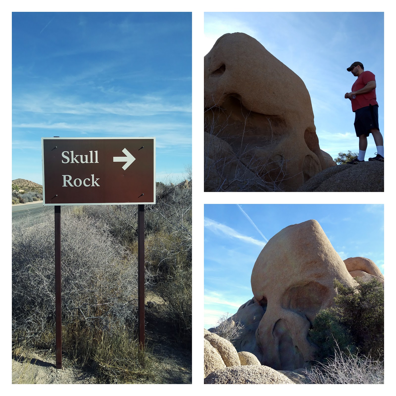
We soon came upon the sign for Skull Rock. After seeing Skull Rock, I felt like every rock I looked at had some sort of facial features. Skull Rock is impressive but there were some really cool rock formations in the area behind it, so we spent a while climbing around back there. We saw a rock with a hole in the top of it, which showed blue sky behind it, as well as a sort of slot canyon. It was really fun climbing around on the rocks and I have a ton or respect for serious climbers, although rock climbing intimidates the hell out of me. 

We then walked across the street to the Discovery Trail. It's a kid friendly nature trail that loops around some more rock formations and there are little signs along the way explaining different flora and fauna. This is a really great area to just stop and look around and take in the different scenery on the horizons. We also saw a roadrunner near the Discovery trail. I tried to take a picture of it but it darted away. Meep meep!

Next on the itinerary was a choice of either the Pine City Hike or Ryan Mountain Hike. It was close to noon time by the time we got to this point since we arrived at the park later than I hoped. I was worried about running out of time for the rest of the stops on our list. In retrospect, we probably could have fit another hike in, but I didn't want to be rushed. So we decided to not do either of these hikes and ate lunch instead. We just sat on the tailgate and used the hatch of the SUV for shade, which was quite pleasant. 

After lunch we drove to Barker Dam and the parking lot was almost full, so I'm glad we got a parking space. Despite that, we didn't actually see too many people on the trail. The dam was really interesting and actually had quite a lot of water in it. It was just mucky rain water but the reflection of the rocks in it was perfectly clear. It was very pretty! The trail to and around the dam was very pleasant to walk along. Be sure to follow the arrow signs once you get to the dam and not just walk back to the parking lot. Around the side of the dam, there is a rock formation that has petroglyphs on it. Some of them are red or black, which is not their original state. People have drawn over them, which is vandalism. Regardless, it was neat to see. 

The website I got the itinerary from said the Lost Horse Mine trail was the author's favorite hike, so I figured we really should not miss out on it. One thing to be aware of, the trail head is located on a dirt road. It was the smoothest dirt road I've ever driven on, so it shouldn't be an issue for any type of car. We had a SUV but sedans should be fine as well. 
There is a 4 mile or 6 mile option and we did the 4 mile. We had time to do 6 but James was getting pretty tired (he was one who drove to Joshua Tree after all, so I figured I'd give him a break). The Lost Horse trail isn't the most strenuous trail ever but it does have some inclines and there is absolutely no shade. It is a very pretty trail and the scenery all around is great. Lots of mountain views off in the distance with snow capped peaks. There are not really any large boulders or rock formations in this part of the park; the scenery is completely different but really beautiful. The mine itself is enclosed with a fence, I suspect probably due to vandalism, but the fence is easy to look through and you're able to get relatively close. 
We finished the hike around 3:30 pm and then drove to Keys View, which is conveniently located on the same road as the Lost Horse Mine hike. We had a little time to kill before sunset but I didn't want to get too far away from Keys view in the event parking became an issue as more people came to watch the sun set. So we chilled in the car for a while and James even napped briefly (I think). Keys View is a mountain overlook high above Palm Springs with views of the San Andreas fault, Salton Sea, Mount Gorgonio, and more. It was similar scenery to what we saw at Garnet Peak, but yet, totally different looking. The Salton Sea looks really cool at sunset, as it reflects the light and basically becomes a giant mirror. There is a formal viewing platform at Keys View but many people were sitting on picnic blankets on the side of the cliff. As the sun started to set, the temperature dropped significantly and the wind started gusting like crazy. I really wanted to see a good sunset but the wind was pretty unbearable. I tried to stick it out but I couldn't even hold my camera still due to the wind. I have a feeling the sunset got better after we left (it's always the best about 20 mins after the sun goes below the horizon) but oh well. 

Leaving Keys view we drove toward the Joshua Tree exit and saw 2 coyotes crossing the road. They were smaller than the ones we have in Georgia. We also saw some rock climbers come down after their final evening climb. And then suddenly we were back in civilization. There was cell service, power lines, and street lights. Joshua Tree really felt like another world. We didn't stick around long enough to experience the darkness of the park but I could tell just being in the small towns bordering the park, it gets very very very dark. 

Honestly, I feel like we experienced more in just one day than I had all year up until this point. I need to come to places like this more often. Away from people, away from civilization. I literally felt different while in the park. 

Cali- Cabrillo National Monument

Despite Cabrillo National Monument being just a short drive from Ocean Beach, we didn't come here the last time we were in town. When we first arrived, we were a little caught off guard because it looks like you are driving into a Navy base but the gate is open and a little ways down the road you stop at the pay station for Cabrillo. As of this writing, it cost $15 to enter Cabrillo by car and this gives you a pass you can use again as much as you want during the next 6 days.

We initially parked near the tide pools area, although it was hide tide and we couldn't access the tide pools. Do yourself a favor, go online and look at the tide schedule (just google San Diego area tide schedule) before you go to the beach in the event you want to look at the tide pools. Also check online (either with a weather app or the park website) about any alerts; there was a rough surf advisory almost every day we were there, which means if you are walking on rocks during high tide, you may get splashed!

There is a nice trail along the cliffs and rocks that is about a mile total, so we started out walking along here. We saw some really cool rock and cliff formations. The thing about the San Diego coastline is, every section of beach is different. The rocks and cliffs at Cabrillo are different than La Jolla, which are different than the Sunset Cliffs, and so on and so on. And of course, everything looks different as the tide changes!

After walking along the trail, we drove up to the visitor's center and parked there. Outside of the visitor's center, we saw great views of the bay, Coronado, downtown San Diego, and even Mexico, although it was a little hazy the morning we were there. There is also a trail near the visitor's center called the Bayside trail (which goes along the bay naturally) but we didn't walk this one. It looked really pretty though! After walking through the visitor's center and looking at the exhibits there, we briefly looked at the actual Cabrillo Monument and then headed to the Old Point Loma lighthouse

I have a thing for lighthouses. I just love them! When I was a kid, I thought it would be cool to be either a lighthouse keeper or a fire tower watcher (weird, I know). This lighthouse is seriously one I could live in. It's very small but seriously has the perfect amount of space for me, James and the dogs. It has a an adorable little spiral staircase leading upstairs to the tower, which is actually not accessible to the public but you can look into it. The rooms of the lighthouse are also secured behind glass, but they are furnished and decorated with period pieces and overall it just looks like a place I could live. I loved the simplicity and stature of this lighthouse! Throughout the grounds near the lighthouse, there are also displays about military history and relics of WW2, which James found interesting. Although I am not so much into military history, the San Diego area is obviously a must visit area for those who are. 

After walking around Cabrillo, we went to the grocery store and did some other mundane things. We needed to get snacks and non-perishable food to take on our trip to Joshua Tree (I didn't feel like bringing a cooler and ice so we stuck with sandwiches and "hiker food"). In the evening, we walked to a restaurant down the street called Hugo's Cocina. We noticed the night before it had a line out the door, so we wanted to see what all the fuss was about. Fortunately, they have a great variety of vegan options so we made a good choice! It's family style Mexican restaurant with your typical assortment of tacos, enchiladas, and combo options. I ordered a vegan quesadilla. It was HUGE so I had plenty leftover, which I ate the next morning for breakfast. 
It was an early night because we had to get a good night's rest before our big adventure in Joshua Tree!

Tuesday, January 23, 2018

Cali- Garnet Peak and Julian

Since the weather was much cooler than our previous visit, I wanted to really get out and hike on this trip. Ultimately, we spent probably 80% of our trip outside and I am completely fine with that! Other than trying to figure out what to wear (it's 60 degrees out- is that shorts weather or pants weather? Answer- shorts if in the sun, pants if in the shade, boots and down jacket if you are a California resident), I loved being outside the whole week. The weather looked like it would be nicest early in the week, so I planned the bulk of our "must do" outdoor activities for Sun- Weds. 

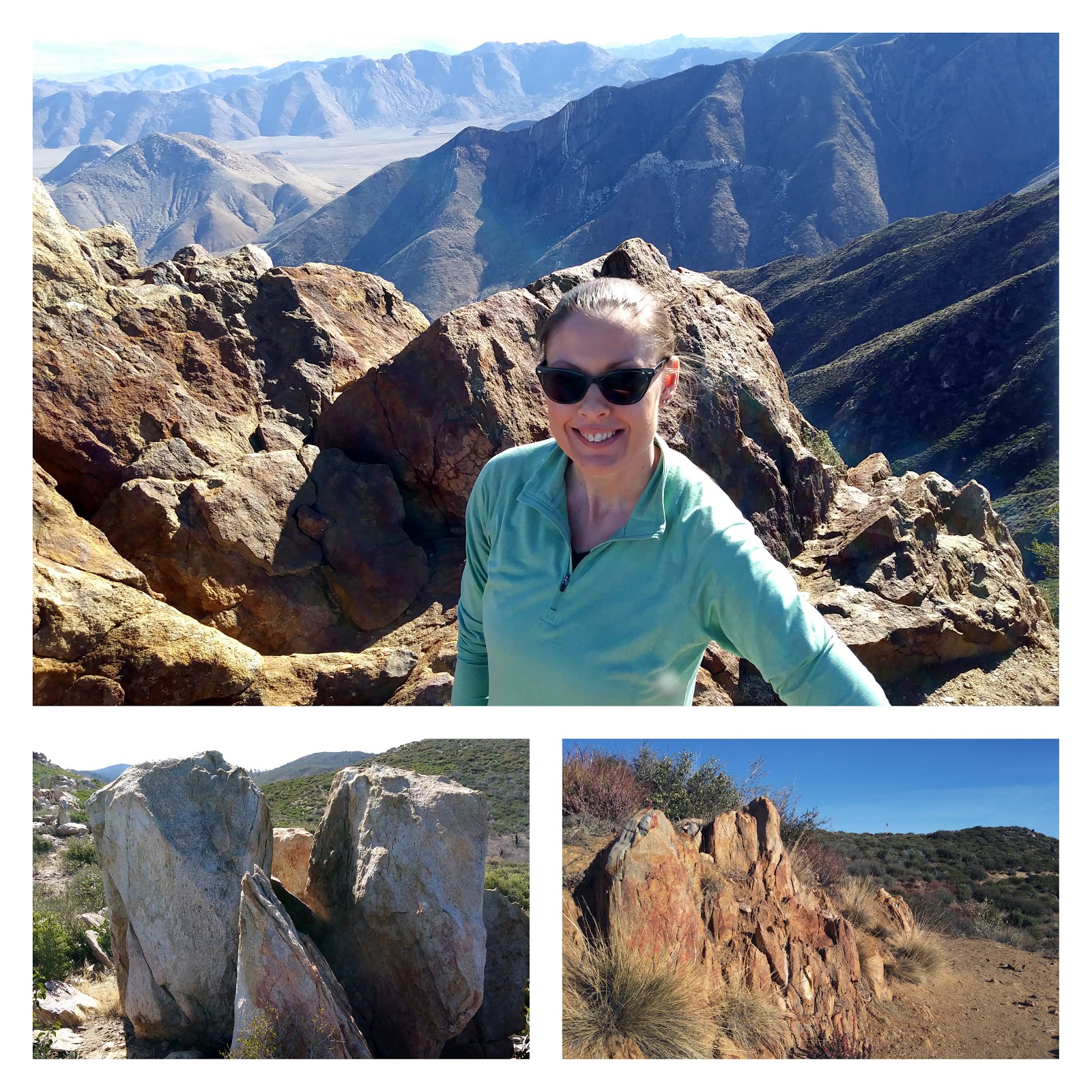
The weather on Monday morning was cool, crisp, and really clear so it was the perfect day to head to the mountains just east of San Diego. I had it in my head to hike some small section of the Pacific Crest Trail, just to say that I had set foot on it, and found a easy sounding (hey, we were on vacation after all) hike to Garnet Peak. I have to say, I think the effort vs. payoff ratio of this hike is best of any hike I've ever taken (in other words, it's not hard and the view was stunning). First of all, it's a very easy, barely an hour drive from San Diego. You hop on I-8, go east, exit onto Sunrise Highway, drive through some very scenic mountain curves, and you're there. No back roads, no 4-wheel drive needed, no worries about GPS going out of service because it's so simple to get there. 

Then there's the hike itself. We started at the Penny Pines trail head, which is about 5 miles round trip, but there are other shorter and longer options nearby. Easiest 5 miles I have ever hiked. About 3/4 of the hike is flat-ish but shows amazing scenery of nearby mountains and valleys. The last section is uphill but short as you climb the summit of Garnet Peak. I will say, I was a little scared on the summit because it's very rocky and I am clumsy. After being so used to big, flat, "balds" of the Georgia mountains, a narrow, rocky mountain top is intimidating. The view was amazing though and so worth it! From the summit, you can see the Anza-Borrego desert, the Salton Sea, and snow capped peaks off in the distance. Quite the variety of geographic features!

Since we were there so early we only saw a handful of other hikers and had plenty of peace and quiet to ourselves. The hike took us about 2 hours total and that was with a lot of stopping to take pictures along the way. We finished earlier than we anticipated, so we decided to drive about 20 minutes north into Julian. I had heard of "Julian Pies" and we figured there was no harm in seeing what it was all about. 
I suppose Julian is like the Ellijay of southern California. They've got mountains and apples and mining and a historic town strip. Julian also seems to have a lot of town pride as everything is called "Julian This" or "Julian That". We went in a few general store type places and yes, found a bakery that sells vegan apple pies. James wanted to go big or go home, so we bought a whole apple pie and then spent the rest of the week trying to eat it. But that's ok because we earned our right to eat whole pies with the amount of hiking/walking we did. 
In the evening, we met our other SD friend for dinner and went to an amazing vegan restaurant/bar called Kindred, which is located in the South Park neighborhood. Not sure who put this place together, but it's an awesome blend of cats, heavy metal, seriously upscale decor, crafty cocktails, and aforementioned vegan cuisine. Truly intriguing. I ordered a BBQ jackfruit sandwich which was leaps and bounds better than the BBQ jackfruit I make at home and I tried Kombucha for the first time. The food prices were very affordable ($10 sandwich w/chips) but the vibe so trendy, this would make a great first date kind of place. 
Only in California can you go from down home apple pie to upscale vegan cuisine in under an hour!